Description
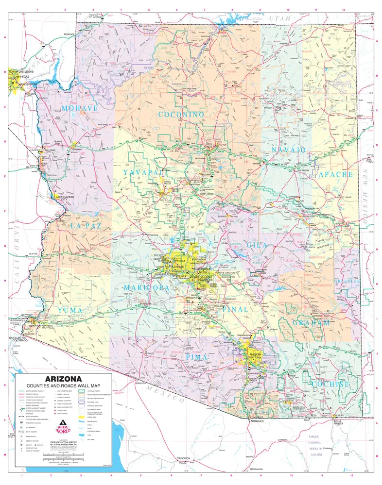
Phoenix Mapping Service Arizona Counties and Roads Large Wall Map Dry Erase Laminated is a State of Arizona dry erase laminated color wall map detailing counties and roads in a large 47″×60″ size.
This detailed and up-to-date State of Arizona wall map defines counties with pastel coloring and is ready for dry erase markers. Also included are cities and towns with relevant population information; all of the interstate, state, and tribal highways systems; rivers, streams, and lakes; mountain ranges; tribal lands, military reservations, wilderness areas, and wildlife refuges; and National Parks, Forests, and Monuments.
Dry Erase Lamination is specialty laminate that allows for dry erase markers to be used on the finished print and erased as desired.
Ready-to-Hang maps have rails at the top and the bottom to keep the map flat against the wall with two loops on the top rail for easy hanging. A package of wall hooks and nails completes the set.
- Ready-to-hang, dry erase laminated, one-sided wall map.
Explore more from our collection.

![Dino's Quiz Map Of The Solar System [Map] Dino Kalogjera And Sanja Kolaj 1](https://carpartsvault.shop/wp-content/uploads/2026/05/61n5FQ5hDBL._SL1000-TSWDOh.tmp_.webp)
![Mexico Mapa De Carreteras [Paperback] Varios 1](https://carpartsvault.shop/wp-content/uploads/2026/05/51tf9UzB5fL._SL1000-92Yl7n.tmp_.webp)
Reviews
There are no reviews yet.