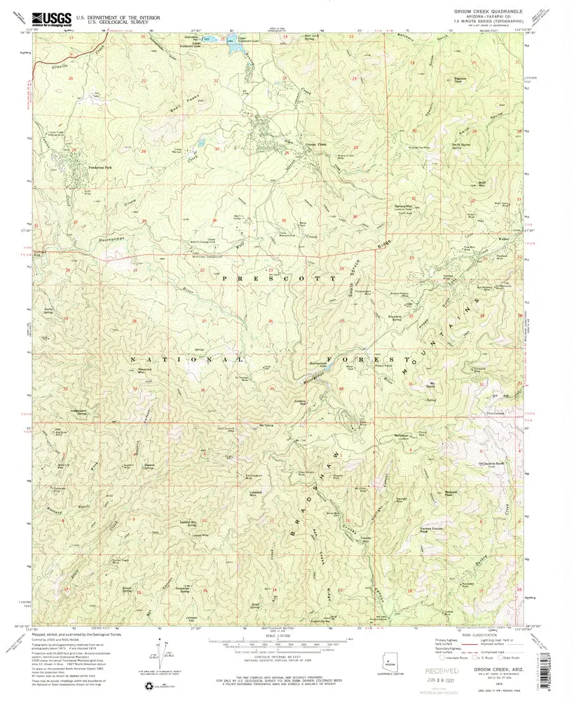
Description
Groom Creek, AZ 1974 USGS 7.5-minute topo quad map
- Product Details
- Product Number: 41045
- Scale: 1:24,000
- Content: Contours
- Alternate ID: TAZ0600
- ISBN: 978-0-607-06648-7
- Version Date: 01/01/1974
- Regions: AZ
- Countries: USA
- Latitude: 34° 30′ 00″ N to 34° 22′ 30″ N
- Longitude: 112° 30′ 00″ W to 112° 22′ 30″ W
- Media: Paper
- Format: Flat
- Historical Reproduction: Yes
- Additional Details
- Description: United States Geological Survey Groom Creek, Arizona Historical Map Reprint 7.5×7.5 Grid 24000-Scale 1974
- Survey Date: 1974
- Print Date: 1977
- Height In Inches: 26.800
- Length In Inches: 22.000
- Boundary Type: Quadrangle
- UTM Grid: Grid Ticks
- Horizontal Datum: North American 1927
- Vertical Datum: National Geodetic 1929
- UTM: Zone 12
- Two-Sided: No
- Plates: 1
- Pieces: 1
- Languages: English
Explore more from our collection.

![Apache Maid Mountain, Arizona 7.5' [Map] United States Geological Survey 1](https://carpartsvault.shop/wp-content/uploads/2026/05/410Z8JECelL._SL1000_dce0475b-5bbc-42d7-84d0-78eeff0231e4-2aslbs.tmp_.webp)

Reviews
There are no reviews yet.