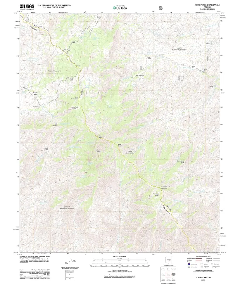
Description
4 Pks, AZ, TNM 2011 UST USGS 7.5-minute topo quad map
- Product Details
- Scale: 1:24,000
- Content: Contours; US Topo
- Draft Version: 0.6.1
- Version Date: 11/14/2011
- Regions: AZ
- Countries: USA
- Latitude: 33° 37′ 30″ N to 33° 45′ 0″ N
- Longitude: 111° 22′ 30″ W to 111° 15′ 0″ W
- Media: Paper
- Format: Flat
- Historical Reproduction: Yes
- Additional Details
- Description: United States Geological Survey Four Peaks, Arizona, The National Map 7.5’×7.5′ Grid 24000-Scale US Topo 2011
- Survey Date: 2011
- Print Date: 2011
- Height In Inches: 29.000
- Length In Inches: 24.000
- Boundary Type: Quadrangle
- UTM Grid: Grid
- Horizontal Datum: North American 1983
- Vertical Datum: National Geodetic 1988
- UTM: Zone 12S
- Two-Sided: No
- Plates: 1
- Pieces: 1
- Languages: English
Explore more from our collection.

![Baja Peninsula Infared From Space Satellite Map Gloss Laminated [Map] Spaceshots Inc. 1](https://carpartsvault.shop/wp-content/uploads/2026/05/41DKYrRbd2L._SL1000_804c6dca-6d63-4e78-ba5f-aedfab787fff-h4Bc68.tmp_.webp)

Reviews
There are no reviews yet.