Description
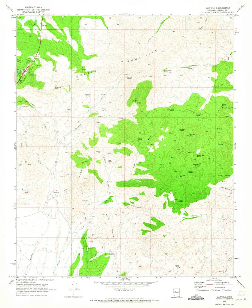
- Long Name: United States Geological Survey Yarnell, Arizona Historical Map Reprint 7.5’×7.5′ Grid 24000-Scale 1969
- Scale: 1:24,000
- Content: Contours
- Alternate ID: TAZ1643
- ISBN: 978-0-607-07423-9
- Version Date: 1969
- Regions: AZ
- Nations: USA
- Latitude: 34° 7′ 30″ N to 34° 15′ 0″ N
- Longitude: 112° 45′ 0″ W to 112° 37′ 30″ W
- Media: Paper
- Format: Flat
- Description: USGS 7.5-minute topo quad map of Yarnell, AZ
- Survey Date: 1969
- Print Date: 1973
- Height In Inches: 26.900
- Width In Inches: 22.000
- Boundary Type: Quadrangle
- Two Sided: No
- Plates: 1
- Pieces: 1
- Languages: English
Explore more from our collection.


![Estado De Baja California Sur [Map] Guia Roji 1](https://carpartsvault.shop/wp-content/uploads/2026/05/51NXwO-_2BFSL._SL1000-rHEoCx.tmp_.webp)
Reviews
There are no reviews yet.