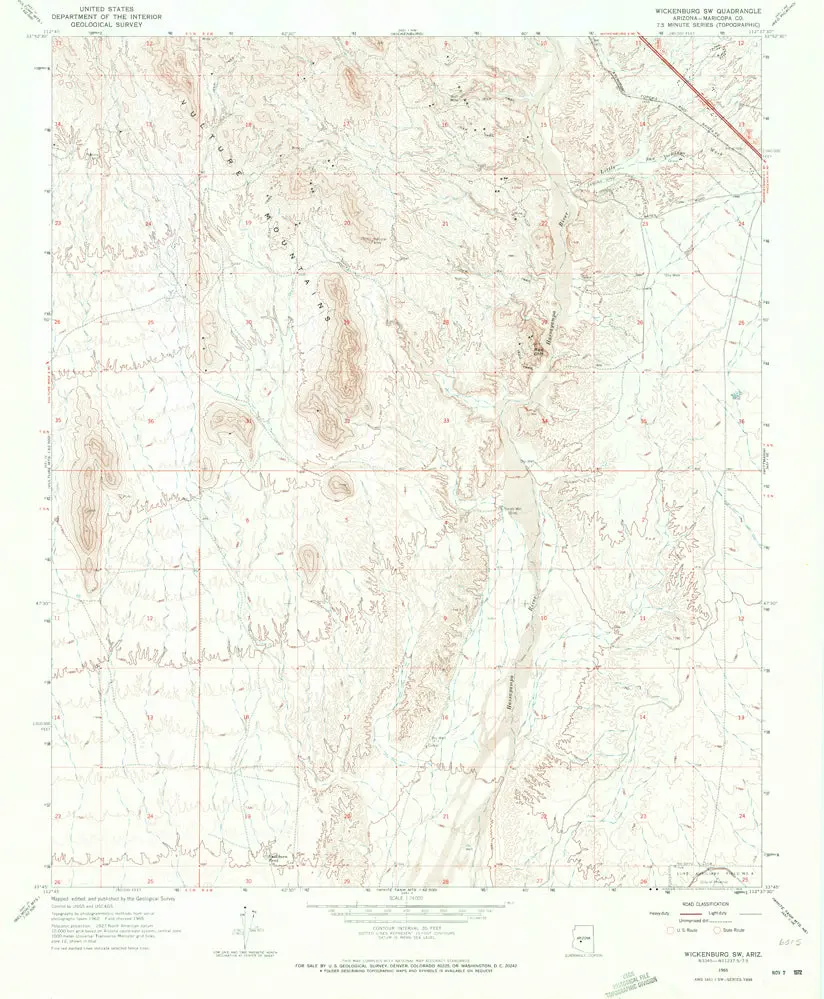
Description
Wickenburg SW, AZ 1965 USGS 7.5-minute quadrangle map
- Product Details
- Product Number: 42042
- Scale: 1:24,000
- Content: Contours
- Alternate ID: TAZ1602
- ISBN: 978-0-607-07391-1
- Version Date: 01/01/1965
- Regions: AZ
- Countries: USA
- Latitude: 33° 52′ 30″ N to 33° 45′ 00″ N
- Longitude: 112° 45′ 00″ W to 112° 37′ 30″ W
- Media: Paper
- Format: Flat
- Historical Reproduction: Yes
- Additional Details
- Description: United States Geological Survey Wickenburg Southwest, Arizona Historical Map Reprint 7.5’×7.5′ Grid 1:24,000-Scale 1965
- Survey Date: 1965
- Print Date: 1973
- Height In Inches: 26.700
- Length In Inches: 22.000
- Boundary Type: Quadrangle
- UTM Grid: Yes
- Horizontal Datum: North American 1927
- Vertical Datum: National Geodetic 1929
- UTM: Zone 12
- Two-Sided: No
- Plates: 1
- Pieces: 1
- Languages: English
Explore more from our collection.

![Dike Tank 7.5' Arizona 1980 [Map] United Stated Geological Survey 1](https://carpartsvault.shop/wp-content/uploads/2026/05/410Z8JECelL._SL1000_ff8cf6a6-59ba-4b88-b5f2-991ca26dc2b6-5zS0Jb.tmp_.webp)

Reviews
There are no reviews yet.