Description
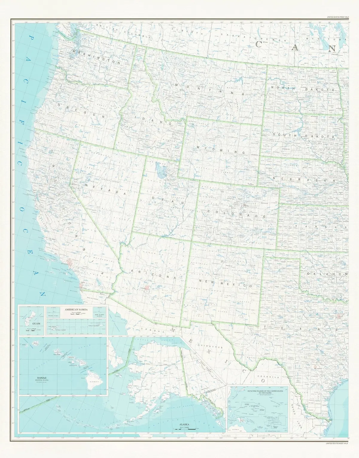
This colorful United States Department of the Interior Geological Survey map shows counties and county seats, states and state capitals, and rivers, streams, and lakes of the United States which are west of 96° West. Inset maps cover Guam, American Samoa, Hawaii Principal Islands, Alaska, and Outlying Islands of the United States in the Pacific.
Dry Erase Lamination is specialty laminate that allows for dry erase markers to be used on the finished print and erased as desired.
- Dry erase lamination, one-sided wall map.
- Scale
* Western USA = 1:25,000,000
* Guam = 1:1,000,000
* American Samoa = 1:1,000,000
* Hawaii Principal Islands = 1:25,000,000
* Alaska = 1:7,500,000 - Size = 42″ x 54″
Explore more from our collection.
![Baja Peninsula Infared From Space Satellite Map Gloss Laminated [Map] Spaceshots Inc. 1](https://carpartsvault.shop/wp-content/uploads/2026/05/41DKYrRbd2L._SL1000_804c6dca-6d63-4e78-ba5f-aedfab787fff-h4Bc68.tmp_.webp)

![Dike Tank 7.5' Arizona 1980 [Map] United Stated Geological Survey 1](https://carpartsvault.shop/wp-content/uploads/2026/05/410Z8JECelL._SL1000_ff8cf6a6-59ba-4b88-b5f2-991ca26dc2b6-5zS0Jb.tmp_.webp)
Reviews
There are no reviews yet.