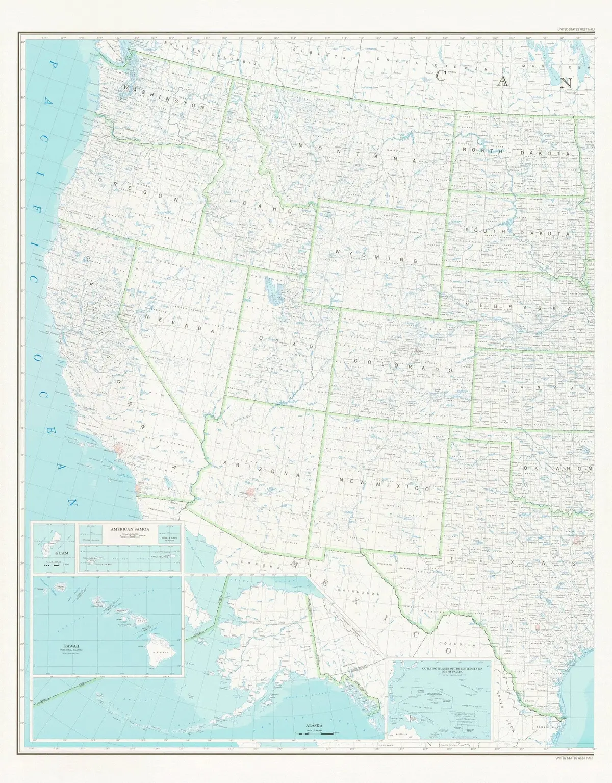
Description
This colorful United States Department of the Interior Geological Survey map shows counties and county seats, states and state capitals, and rivers, streams, and lakes of the United States which are west of 96° West. Inset maps cover Guam, American Samoa, Hawaii Principal Islands, Alaska, and Outlying Islands of the United States in the Pacific.
The map is a convenient and useful at-a-glance reference ready for highlighters, sticker dots or arrows, or graphic tape.
- Paper, one-sided wall map.
- Scale
* Western USA = 1:25,000,000
* Guam = 1:1,000,000
* American Samoa = 1:1,000,000
* Hawaii Principal Islands = 1:25,000,000
* Alaska = 1:7,500,000 - Size = 42″ x 54″
Explore more from our collection.
![Douglas Ne 7.5', Arizona [Map] United Stated Geological Survey 1](https://carpartsvault.shop/wp-content/uploads/2026/05/410Z8JECelL._SL1000_960643bf-125f-462b-8727-48bf6bdc1077-1K0TR9.tmp_.webp)

![Apache Maid Mountain, Arizona 7.5' [Map] United States Geological Survey 1](https://carpartsvault.shop/wp-content/uploads/2026/05/410Z8JECelL._SL1000_dce0475b-5bbc-42d7-84d0-78eeff0231e4-2aslbs.tmp_.webp)
Reviews
There are no reviews yet.