
Description
Expertly researched and designed, National Geographic‘s United States Wall Map is the standard by which other reference maps of the U.S. are measured.
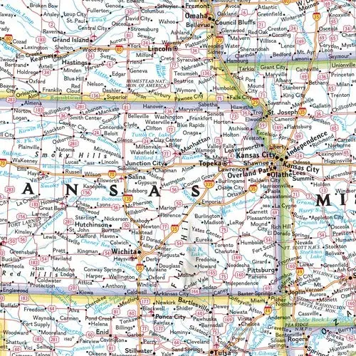
Product Features:
- Signature Classic styling with bright, easy to read color palette with blue water and colorful state borders
- All 50 states with insets for Hawaiian Islands and Alaska plus inset showing relative size of Alaska
- Clearly defined state and country boundaries, cities, islands, national parks, and physical features
- Thousands of place names carefully and artfully placed to maintain legibility in heavily populated areas
- Background shows mountain ranges and valleys in subtle shaded relief with mountain ranges labeled
- Major water bodies including rivers, lakes, gulfs, bays, straits, and ocean bathymetry
- Transportation routes including interstate highways, major state routes, airports, waterways, canals, and ferries
The map is packaged in a two inch diameter tube with a label showing a thumbnail of the map with dimensions and other pertinent information.
- Map Scale = 1:4,561,000
- Sheet Size = 43.5″ × 30.5″
- 44310TP
Explore more from our collection.

![Dome Rock Mts Sw, Arizona 7.5' [Map] United Stated Geological Survey 1](https://carpartsvault.shop/wp-content/uploads/2026/05/419-VJ68DR.tmp_.webp)

Reviews
There are no reviews yet.