Description
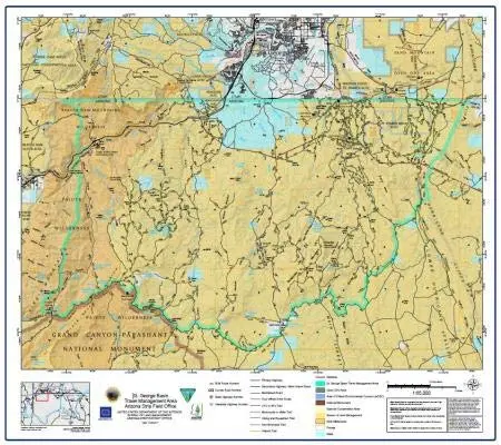
The United States Department of the Interior Bureau of Land Management Arizona Strip Field Office St. George Basin Travel Management Area Full-Size Paper/Non-Laminated was last updated in January 2021. The purpose of this map is to show the updated public land access routes to federal lands administered by the BLM from the public highways, and the motorized route network established for BLM lands to provide for vehicle access for multiple purposes including administrative and public recreational use. The BLM access route network consists of primitive roads in rough to extreme rough condition, and several non-motorized trails. BLM lands are accessed from the state and federal highways by county-maintained roads and other public land access routes across non-BLM lands. Federal lands administered by the BLM are open to public use, including use of Off Highway Vehicles, subject to public land regulations at 43CFR8360, and 43CFR8340.
The map is a convenient and useful at-a-glance reference ready for highlighters, sticker dots or arrows, or graphic tape.
- Paper/non-laminated, one-sided wall map.
- Size: 28.25″×24.5″
- Scale: 1:65,000
- Projection: Lambert Conformal Conic
- Datum: North American 1983
- Contour Interval: 100 feet
- Longitude/Latitude Grid Interval: 5 minutes
- UTM Interval: 5 kilometers
Explore more from our collection.


Reviews
There are no reviews yet.