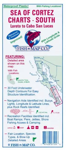
Description
Sea of Cortez South, Loreto to Cabo San Lucas features:
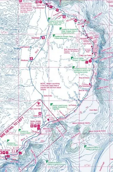
- 30-foot underwater depth contours
- Numerous fishing suggestions
- Detailed areas for Bahia de la Paz, Isla Espirito Santo, Cabo San Lucas, and Loreto
- Latitude and longitude grids provided
- Rock Reefs Identified
- Boat Ramps, Piers, and Jetties shown
- This is a 2-sided map and has been printed onto a waterproof, tear-resistant material.
- This map folds to 9″ × 4″ and unfolds to 3′ × 2′.
- Fishing Map Features
- Contours: 30′
- Scale: 1:160,000 / Cabo San Lucas 1:167,000 / Las Paz to Cabo 1:334,000
- GPS Data: No
- Water Type: Salt
- Region/State(s): Baja California Sur, Mexico
- UPC: 761428 071248
Explore more from our collection.
![Dome Rock Mts Sw, Arizona 7.5' [Map] United Stated Geological Survey 1](https://carpartsvault.shop/wp-content/uploads/2026/05/419-VJ68DR.tmp_.webp)

![Apache Maid Mountain, Arizona 7.5' [Map] United States Geological Survey 1](https://carpartsvault.shop/wp-content/uploads/2026/05/410Z8JECelL._SL1000_dce0475b-5bbc-42d7-84d0-78eeff0231e4-2aslbs.tmp_.webp)
Reviews
There are no reviews yet.