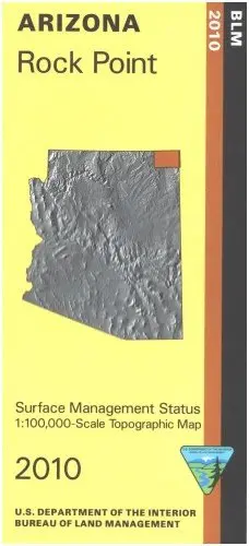
Description
Differentiates between public and private land, and also among the various agencies who manage the public lands. Entire map shows Navajo Indian Reservation. No public land. Map shows Hwy 191 north to south.
Product Details
Product Number
242675
Scale
1:100,000
Alternate ID
AZ167S
ISBN
978-1-4113-2990-4
Authors
BLM
Version Date
01/01/2010
Regions
AZ
Countries
USA
Media
Paper
Format
Folded
Additional Details
Description
SURFACE MANAGEMENT MAP
Survey Date
2010
Print Date
2010
Height In Inches
27.000
Length In Inches
39.500
Boundary Type
Quadrangle
Two Sided
No
Pieces
1
Languages
English
Explore more from our collection.
![Arizona's White Mountains [Map] Russel Mead 1](https://carpartsvault.shop/wp-content/uploads/2026/05/51Yr21jVcsL._SL1000-9RhxEj.tmp_.webp)

![Dome Rock Mts Sw, Arizona 7.5' [Map] United Stated Geological Survey 1](https://carpartsvault.shop/wp-content/uploads/2026/05/419-VJ68DR.tmp_.webp)
Reviews
There are no reviews yet.