Description
- Description
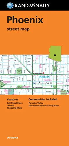
- Rand McNally‘s folded map for Phoenix is a must-have for anyone traveling in and around this part of Arizona, offering unbeatable accuracy and reliability at a great price. Our trusted cartography shows all Interstate, U.S., state, and county highways, along with clearly indicated parks, points of interest, airports, county boundaries, and streets. The easy-to-use legend and detailed index make for quick and easy location of destinations. You’ll see why Rand McNally folded maps have been the trusted standard for years.
- Regularly updated
- Full-color maps
- Clearly labeled Interstate, U.S., state, and county highways
- Indications of parks, points of interest, airports, county boundaries, schools, shopping malls, downtown & vicinity maps
- Easy-to-use legend
- Detailed index & full street index
- Convenient folded size
- Copyright 2015 February 09
- Coverage Area
- Communities Included: Paradise Valley, downtown, & vicinity maps
- Product Details
- Measures 4.5′ × 9′ and folds out to 28′ × 40′
- ISBN-10: 0528007610
- Folded Maps: City/Street
- Two-sided, self-cover, paper/non-laminated folded map
Explore more from our collection.


![Estado De Baja California Sur [Map] Guia Roji 1](https://carpartsvault.shop/wp-content/uploads/2026/05/51NXwO-_2BFSL._SL1000-rHEoCx.tmp_.webp)
Reviews
There are no reviews yet.