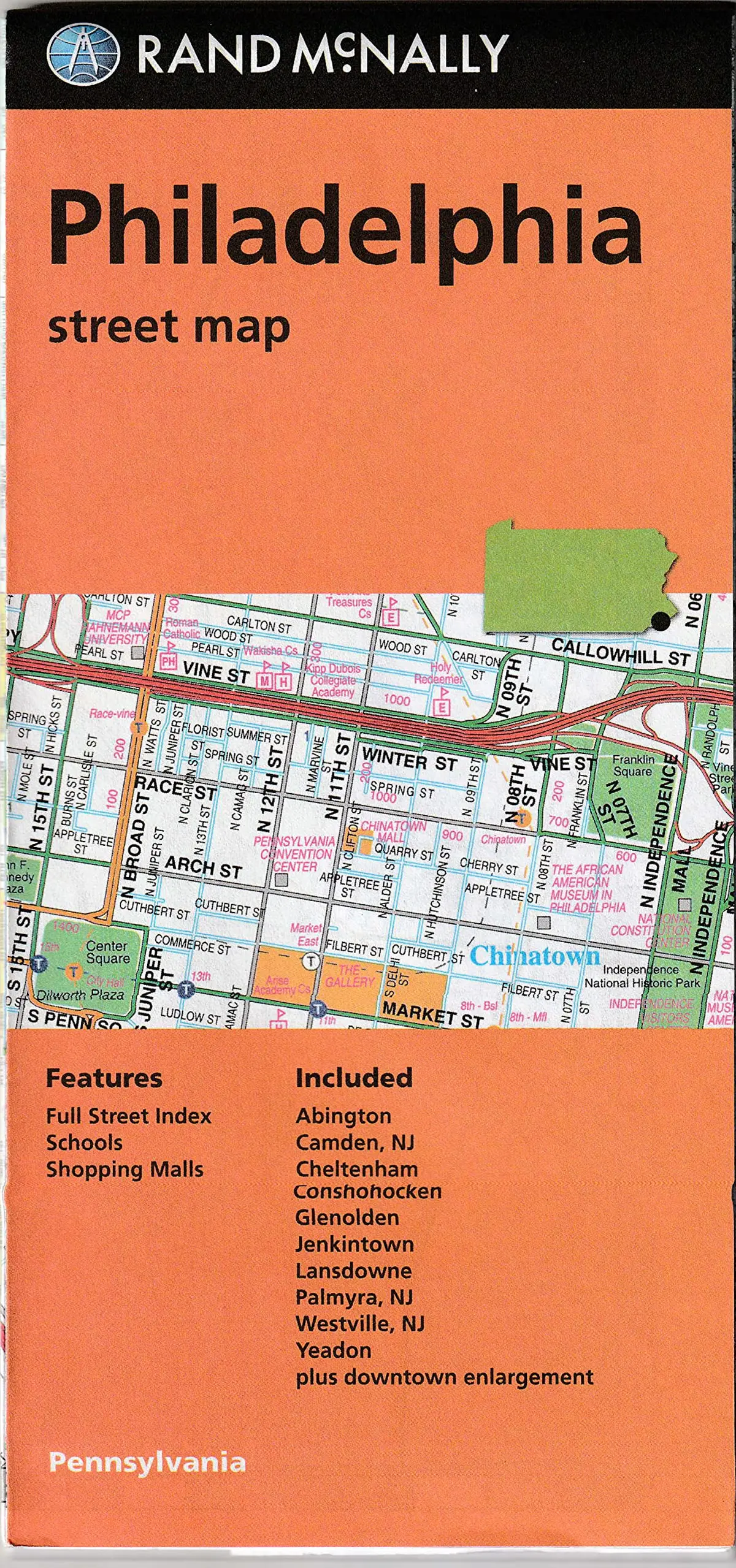
Description
Rand McNally‘s folded map for Philadelphia is a must-have for anyone traveling in and around this part of Pennsylvania, offering unbeatable accuracy and reliability at a great price. Our trusted cartography shows all Interstate, U.S., state, and county highways, along with clearly indicated parks, points of interest, airports, county boundaries, and streets. The easy-to-use legend and detailed index make for quick and easy location of destinations. You’ll see why Rand McNally folded maps have been the trusted standard for years.
- Description
- Regularly updated
- Full-color maps
- Clearly labeled Interstate, U.S., state, and county highways
- Indications of parks, points of interest, airports, county boundaries, schools, shopping malls, downtown & vicinity maps
- Easy-to-use legend
- Detailed & full street index
- Convenient folded size
- Copyright 2023
- Coverage Area
- Communities Included: Cheltenham, Collingdale, Colwyn, Derby, East Lansdowne, Folcroft, Glenolden, Jenkintown, Lansdowne, Millbourne, Narberth, Norwood, Rockledge, Sharon Hill, Yeadon plus downtown enlargement.
- Product Details
- Measures 4′ × 9.5′ and folds out to 28′ × 40′.
- Additional Info
- SKU: 052802521X
- UPC: 9780528008658
- Folded Maps: City/Street
Explore more from our collection.
![Dino's Quiz Map Of The Solar System [Map] Dino Kalogjera And Sanja Kolaj 1](https://carpartsvault.shop/wp-content/uploads/2026/05/61n5FQ5hDBL._SL1000-TSWDOh.tmp_.webp)


Reviews
There are no reviews yet.