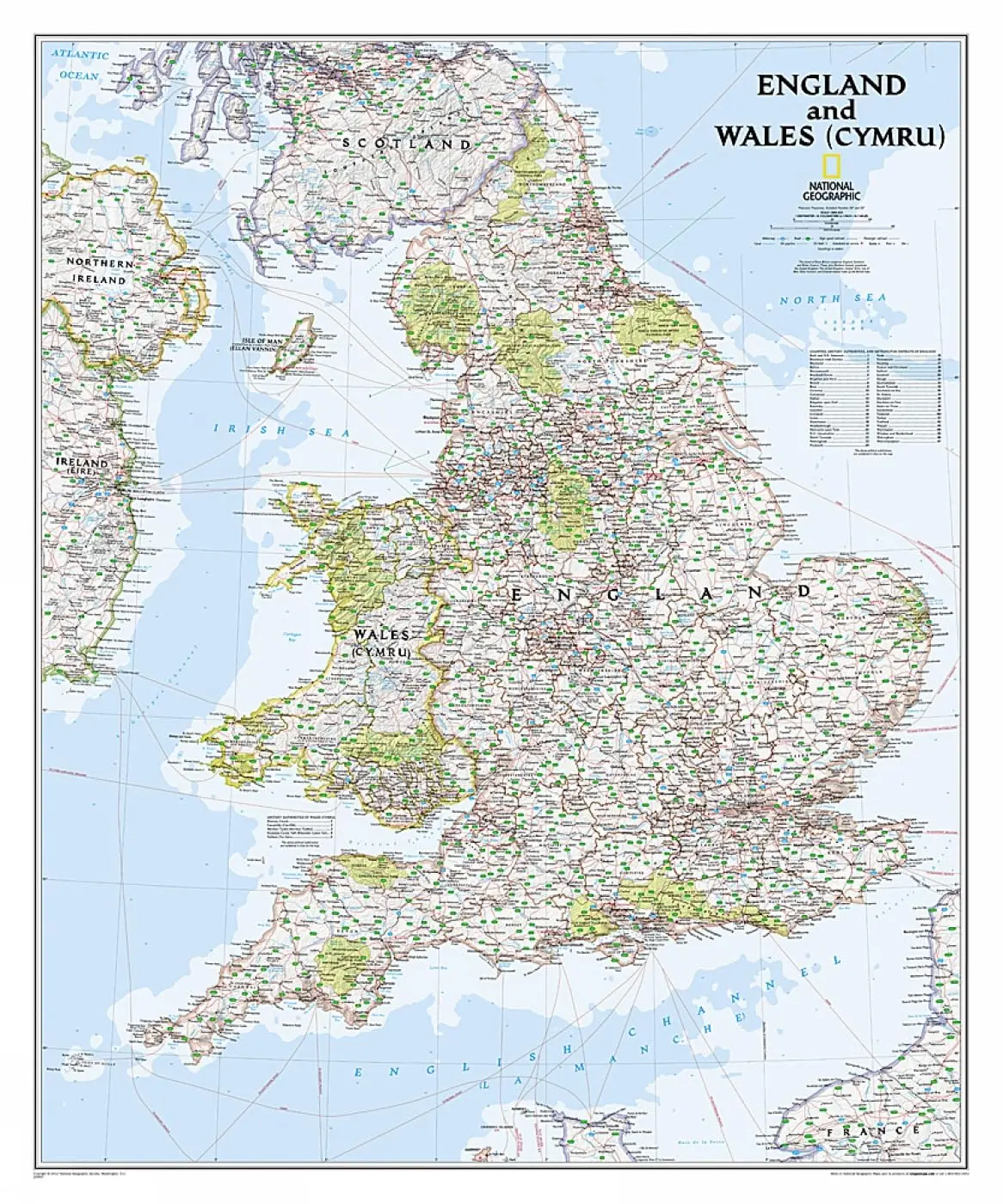

Description
Expertly researched and designed, National Geographic‘s Classic style wall map of England and Wales (Cymru) provides exceptional detail of two of the three regions that make up the island of Great Britain. The map features a bright color palette with blue oceans and terrain detailed in stunning shaded relief that has been a hallmark of National Geographic wall maps for over 75 years. Administrative divisions are clearly defined and thousands of place names including cities, historical sites, bodies of water, national parks, and more are shown. The region’s transportation infrastructure is detailed as well, with clearly indicated roads, motorways, airports, canals, ferry routes, and high-speed and passenger railroads. Coastal bathymetry is shown with depth curves and soundings. In addition to England and Wales (Cymru), coverage includes portions of Scotland, Northern Ireland, Ireland, and France.
The map is packaged in a two inch diameter tube with a label showing a thumbnail of the map with dimensions and other pertinent information.
- Map Scale = 1:868,000
- Sheet Size = 30″ × 36″
Explore more from our collection.
![Estado De Baja California Sur [Map] Guia Roji 1](https://carpartsvault.shop/wp-content/uploads/2026/05/51NXwO-_2BFSL._SL1000-rHEoCx.tmp_.webp)
![Douglas Ne 7.5', Arizona [Map] United Stated Geological Survey 1](https://carpartsvault.shop/wp-content/uploads/2026/05/410Z8JECelL._SL1000_960643bf-125f-462b-8727-48bf6bdc1077-1K0TR9.tmp_.webp)
![Dike Tank 7.5' Arizona 1980 [Map] United Stated Geological Survey 1](https://carpartsvault.shop/wp-content/uploads/2026/05/410Z8JECelL._SL1000_ff8cf6a6-59ba-4b88-b5f2-991ca26dc2b6-5zS0Jb.tmp_.webp)
Reviews
There are no reviews yet.