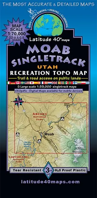
Description
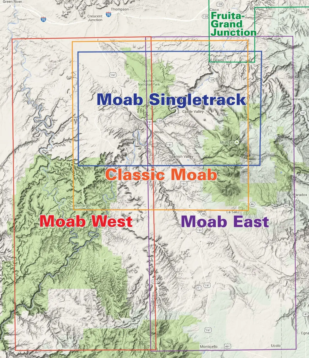
- Map Coverage covers all or part of 22 USGS 1:24,000 7.5-minute topographic maps
- North – Dewey Bridge
- South – Hurrah Pass
- East – Dolores River Overlook
- West -approximately 4 miles west of Horsethief Campground
- Size
- 39″ × 25″ flat
- 4″ × 8″ folded
- Scale
- 1:70,000
- 1 inch = 1.1 miles or 1.76 kms
- Contour Interval 50 feet with shaded relief base
- Latest Edition = 3rd Edition – 2021 March 18
- Notes
- Close-up maps of
- Sovereign Area Trails
- Amasa Back Singletrack
- Dead Horse Point State Park Trails
- Slickrock Trail
- Gemini Bridges Singletrack/Magnificent 7 MTB Route
- Klondike Bluffs Singletrack
- Enlarged map insets for Moab’s most popular singletrack trails
- GPSed trails & roads
- Tear-resistant, water-proof plastic
- Two-sided, self-cover folded map
- Close-up maps of
Explore more from our collection.
![Mexico Mapa De Carreteras [Paperback] Varios 1](https://carpartsvault.shop/wp-content/uploads/2026/05/51tf9UzB5fL._SL1000-92Yl7n.tmp_.webp)

![Dike Tank 7.5' Arizona 1980 [Map] United Stated Geological Survey 1](https://carpartsvault.shop/wp-content/uploads/2026/05/410Z8JECelL._SL1000_ff8cf6a6-59ba-4b88-b5f2-991ca26dc2b6-5zS0Jb.tmp_.webp)
Reviews
There are no reviews yet.