Description
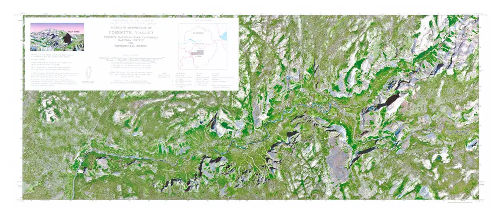
Description: Use this United States Geological Survey map to teach and learn about the landforms and other physical features of the national park. An orthoimage is remotely sensed image data in which displacement of features in the image caused by terrain relief and sensor orientation have been mathematically removed. Orthoimagery combines the image characteristics of a photograph with the geometric qualities of a map.
- Product Details
- Product Number: 47258
- Scale: 1:24,000
- Alternate ID: TCA4109
- ISBN: 978-0-607-83312-6
- Version Date: 01/01/1986
- Regions: CA
- Countries: USA
- Media: Paper
- Format: Flat
- Additional Details
- Survey Date: 1986
- Print Date: 1991
- Height In Inches: 18.000
- Length In Inches: 42.000
- Boundary Type: Political Unit
- Two-Sided: No
- Pieces: 1
- Languages: English
Explore more from our collection.
![Mexico Mapa De Carreteras [Paperback] Varios 1](https://carpartsvault.shop/wp-content/uploads/2026/05/51tf9UzB5fL._SL1000-92Yl7n.tmp_.webp)
![Baja Peninsula Infared From Space Satellite Map Gloss Laminated [Map] Spaceshots Inc. 1](https://carpartsvault.shop/wp-content/uploads/2026/05/41DKYrRbd2L._SL1000_804c6dca-6d63-4e78-ba5f-aedfab787fff-h4Bc68.tmp_.webp)

Reviews
There are no reviews yet.