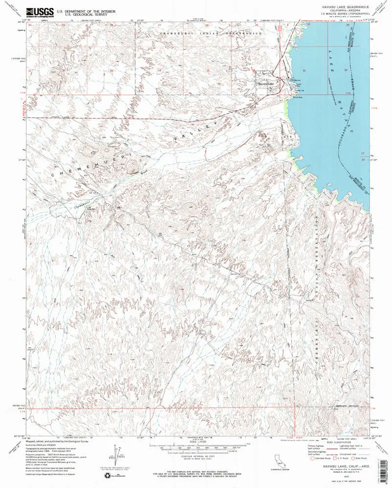

Description
Havasu Lake, CA-AZ, 1970 USGS 7.5-minute topo quad map
- Product Details
- Product Number: 44211
- Scale: 1:24,000
- Content: Contours
- Alternate ID: TCA0999
- ISBN: 978-0-607-08904-2
- Version Date: 01/01/1970
- Regions: AZ, CA
- Countries: USA
- Latitude: 34° 30′ 00″ N to 34° 22′ 30″ N
- Longitude: 114° 30′ 00″ W to 114° 22′ 30″ W
- Media: Paper
- Format: Flat
- Historical Reproduction: Yes
- Additional Details
- Description: United States Geological Survey Havasu Lake, California-Arizona Historical Map Reprint 7.5×7.5 Grid 24000-Scale 1970
- Survey Date: 1970
- Print Date: 1982
- Height In Inches: 26.800
- Length In Inches: 21.500
- Boundary Type: Quadrangle
- UTM Grid: Ticks
- Horizontal Datum: North American 1927
- Vertical Datum: National Geodetic 1929
- UTM: Zone 11
- Two-Sided: No
- Plates: 1
- Pieces: 1
- Languages: English
Explore more from our collection.
![Dino's Quiz Map Of The Solar System [Map] Dino Kalogjera And Sanja Kolaj 1](https://carpartsvault.shop/wp-content/uploads/2026/05/61n5FQ5hDBL._SL1000-TSWDOh.tmp_.webp)


Reviews
There are no reviews yet.