Description
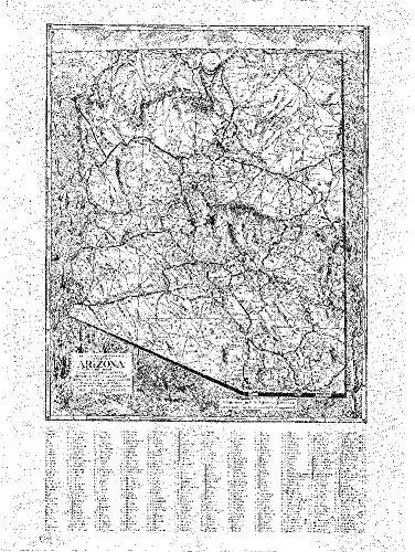
This faithful reproduction of the State of Arizona in 1939, originally drawn in 1937 and revised in 1939, shows county lines, mountains, rivers, railways, U.S. highways, state highways, county and other roads, national monuments, and places of interest. A historical reproduction, the original map was created for the Arizona Mapping Service.
Gloss Lamination features premium optically clear film which provides a high shine for dramatic color presentation.
Ready-to-Hang maps have rails at the top and the bottom to keep the map flat against the wall with two loops on the top rail for easy hanging. A package of wall hooks and nails completes the set.
- Ready-to-hang gloss laminated paper, one-sided wall map.
- Size: 24″ × 32″.
- Harriett F. Cobb and P. T. Reeve.
Explore more from our collection.
![Mexico Central Map By Guia Roji (Bilingual) (Spanish Edition) (English And Spanish Edition) [Map] Guia Roji 1](https://carpartsvault.shop/wp-content/uploads/2026/05/5196CDNB7GL._SL1000-t007Bz.tmp_.webp)

![Douglas Ne 7.5', Arizona [Map] United Stated Geological Survey 1](https://carpartsvault.shop/wp-content/uploads/2026/05/410Z8JECelL._SL1000_960643bf-125f-462b-8727-48bf6bdc1077-1K0TR9.tmp_.webp)
Reviews
There are no reviews yet.