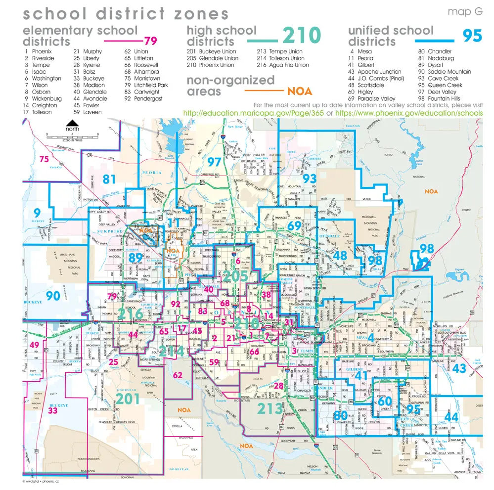
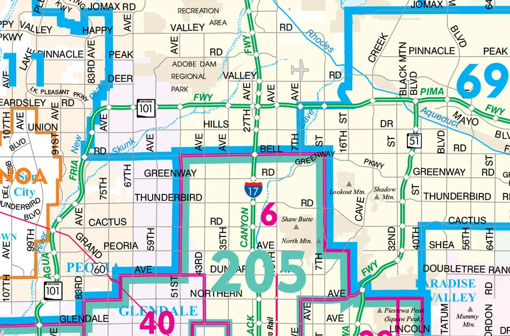
Description
The perfect wall map for school administrators, substitute teachers, government agencies, or businesses, this wall map shows the boundaries of each school district and non-organized area. School districts are color coded by elementary, high school, and unified, as well as non-organized areas. This map includes highways, arterial (major) roads, lightrail, airports, rivers, lakes, regional parks, national forests, municipalities, and indigenous communities.
Gloss Lamination features premium optically clear film which provides a high shine for dramatic color presentation. The gloss lamination makes this map a convenient and useful detailed reference ready for wet erase markers, sticker dots, or graphic tape for locations, areas, and zones.
- 36″ × 36″ gloss laminated, one-sided wall map.
Explore more from our collection.

![Dome Rock Mts Sw, Arizona 7.5' [Map] United Stated Geological Survey 1](https://carpartsvault.shop/wp-content/uploads/2026/05/419-VJ68DR.tmp_.webp)

Reviews
There are no reviews yet.