Description
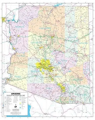
Phoenix Mapping Service Arizona Counties and Roads Small Wall Map, Gloss Laminated is a State of Arizona color wall map detailing counties and roads in a small 24″ × 30″ size.
This detailed and up-to-date State of Arizona wall map defines counties with pastel coloring. Also included are cities and towns with relevant population information; all of the interstate, state, and tribal highways systems; rivers, streams, and lakes; mountain ranges; tribal lands, military reservations, wilderness areas, and wildlife refuges; and National Parks, Forests, and Monuments.
Gloss Lamination features premium optically clear film which provides a high shine for dramatic color presentation. The gloss laminated map is a convenient and useful at-a-glance reference ready for wet erase or alcohol erase markers, sticker dots or arrows, or graphic tape.
- Gloss laminated paper, one-sided wall map.
- Size = 24″ × 30″
Explore more from our collection.

![Dino's Quiz Map Of The Solar System [Map] Dino Kalogjera And Sanja Kolaj 1](https://carpartsvault.shop/wp-content/uploads/2026/05/61n5FQ5hDBL._SL1000-TSWDOh.tmp_.webp)
![Baja Peninsula Infared From Space Satellite Map Gloss Laminated [Map] Spaceshots Inc. 1](https://carpartsvault.shop/wp-content/uploads/2026/05/41DKYrRbd2L._SL1000_804c6dca-6d63-4e78-ba5f-aedfab787fff-h4Bc68.tmp_.webp)
Reviews
There are no reviews yet.