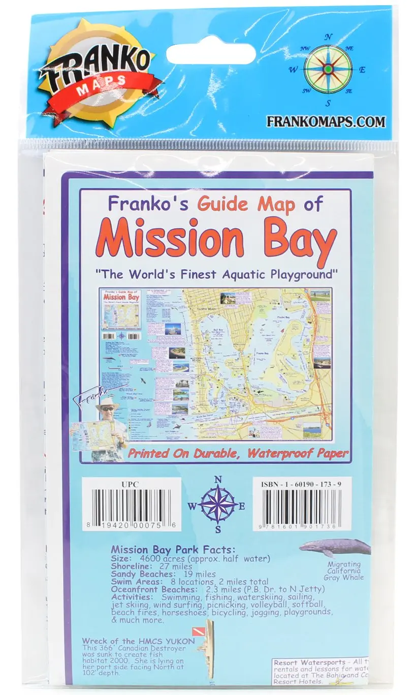
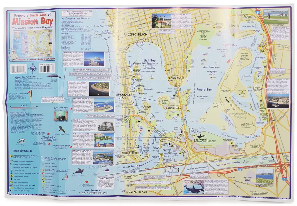
Description
Waterproof guide map. Side one shows all of Mission Bay, including every detail of what is there, all roads, bike paths, parks, beaches, waterski launches, sailing and motor boating , kayaking, personal watercraft zones, swim areas, lifeguard towers, boat beaching spots, and much more. Side two is a list of all of the rules and regulations for boaters, fishermen, water skiers, PWC users, and all other users of Mission Bay.
Covers the “aquatic playground” of Mission Bay, San Diego, California. Includes Pacific Beach, Mission Beach, Sail Bay, Fiesta Bay, Ocean Beach, and Sea World. The map shows locations for water sports, recreation, and points of interest. Side 2 is full of detailed, useful info on Mission Bay regulations. Printed on durable, waterproof material. 14″ × 21″, folded to a convenient 4″ × 7″.
- 2009 July 23 by Frank M. Nielsen
- Two-sided, self-cover, plastic folded map
Explore more from our collection.


![Mexico Mapa De Carreteras [Paperback] Varios 1](https://carpartsvault.shop/wp-content/uploads/2026/05/51tf9UzB5fL._SL1000-92Yl7n.tmp_.webp)
Reviews
There are no reviews yet.