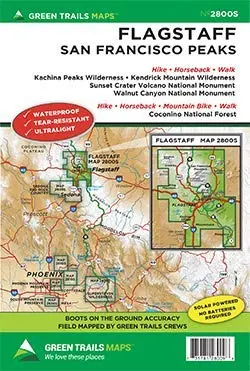
Description
On the edge of the Colorado Plateau this new map covers all of the extensive San Francisco Peaks trail network and the surrounding urban trail system of Flagstaff. Epic trails up the highest Peak in AZ and down to Native Cliff dwellings, around ancient stratovolcanoes along lush pine canyons await. Year-round multi-use adventures on foot, bike, or horse await in this outdoor lovers paradise. Printed on a rugged Waterproof – Tear Resistant Sheet.
- Original Issue : 2017
- Current Issue : 2017
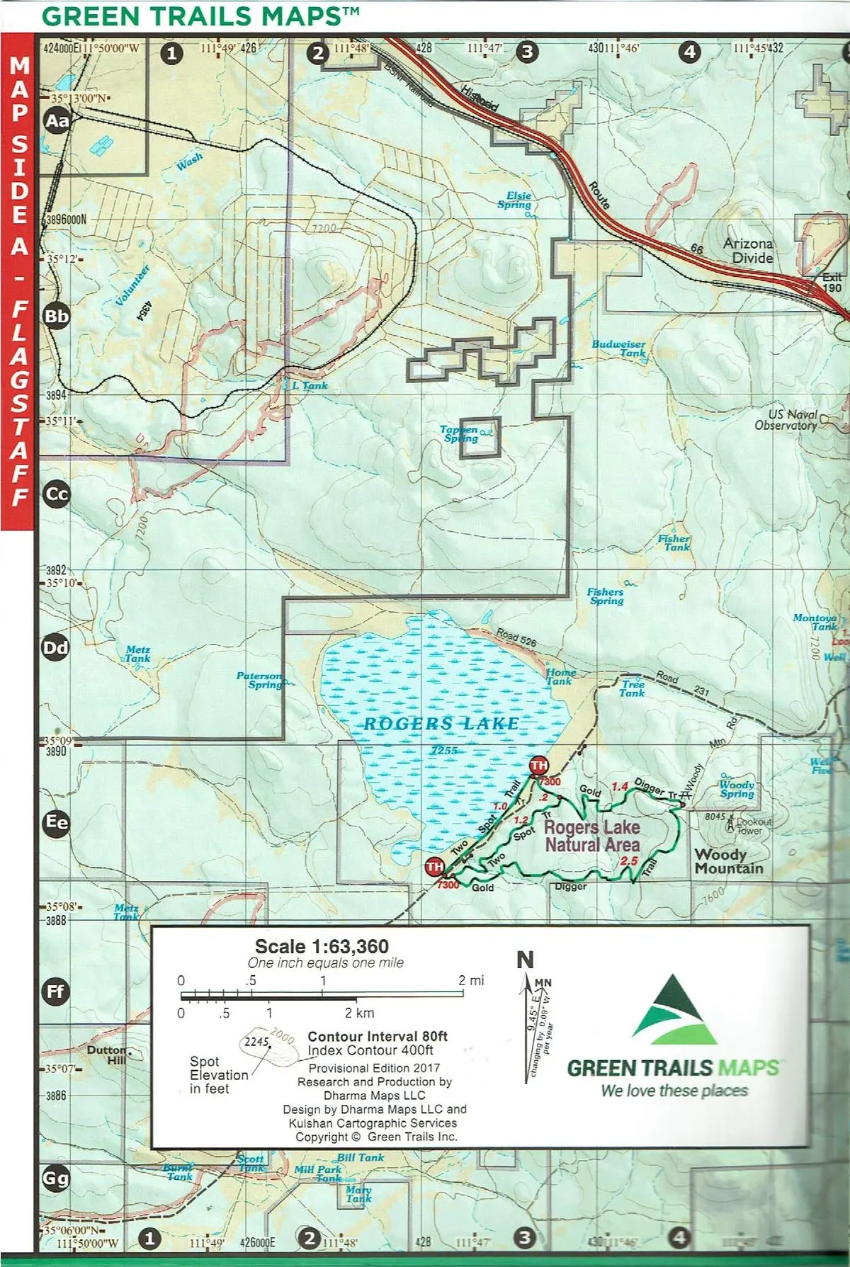
- Scale : 1:63360
- Projection : UTM
- UTM Zone : 11
- Sheet Size/Type : 18 × 24 Inch
- Folded : 6 × 9 Inch
Hike, horseback, or walk Kachina Peaks Wilderness, Kendrick Mountain Wilderness, Sunset Crater Volcano National Monument, and/or Walnut Canyon National Monument. Hike, horseback, mountain bike, or walk Coconino National Forest.
- Map Scale 1:63,360.
- Provisional Edition 2017, Reprinted 2023.
- Two-sided, self-cover, plastic folded map.
Explore more from our collection.
![Dome Rock Mts Sw, Arizona 7.5' [Map] United Stated Geological Survey 1](https://carpartsvault.shop/wp-content/uploads/2026/05/419-VJ68DR.tmp_.webp)
![Apache Maid Mountain, Arizona 7.5' [Map] United States Geological Survey 1](https://carpartsvault.shop/wp-content/uploads/2026/05/410Z8JECelL._SL1000_dce0475b-5bbc-42d7-84d0-78eeff0231e4-2aslbs.tmp_.webp)
![Dino's Quiz Map Of The Solar System [Map] Dino Kalogjera And Sanja Kolaj 1](https://carpartsvault.shop/wp-content/uploads/2026/05/61n5FQ5hDBL._SL1000-TSWDOh.tmp_.webp)
Reviews
There are no reviews yet.