Description
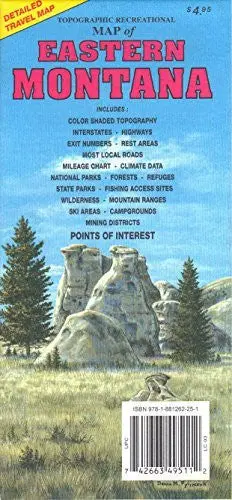
GTR Mapping Topographic Recreational Map of Eastern Montana color shaded topography, interstates, highways, exit numbers, rest areas, most local roads, mileage chart, climate data, national parks, forests, refuges, state parks, fishing access sites, wilderness, mountain ranges, ski areas, campgrounds, mining districts, and points of interest.
- Two-sided, self-cover, paper/non-laminated
Explore more from our collection.
![Baja Peninsula Infared From Space Satellite Map Gloss Laminated [Map] Spaceshots Inc. 1](https://carpartsvault.shop/wp-content/uploads/2026/05/41DKYrRbd2L._SL1000_804c6dca-6d63-4e78-ba5f-aedfab787fff-h4Bc68.tmp_.webp)

![Apache Maid Mountain, Arizona 7.5' [Map] United States Geological Survey 1](https://carpartsvault.shop/wp-content/uploads/2026/05/410Z8JECelL._SL1000_dce0475b-5bbc-42d7-84d0-78eeff0231e4-2aslbs.tmp_.webp)
Reviews
There are no reviews yet.