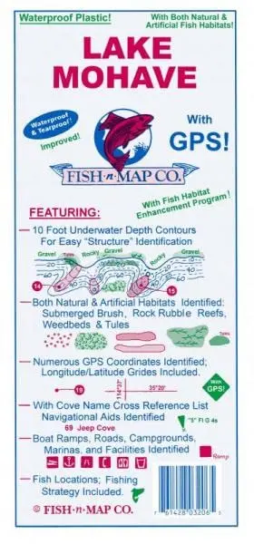
Description
- Underwater Topography Fishing Map Features
- Contours: 10′
- Scale: 1:27,900
- GPS Data: Yes
- Water Type: Fresh
- States: Arizona and Nevada
- UPC: 761428 032065
- Notes on this fishing map
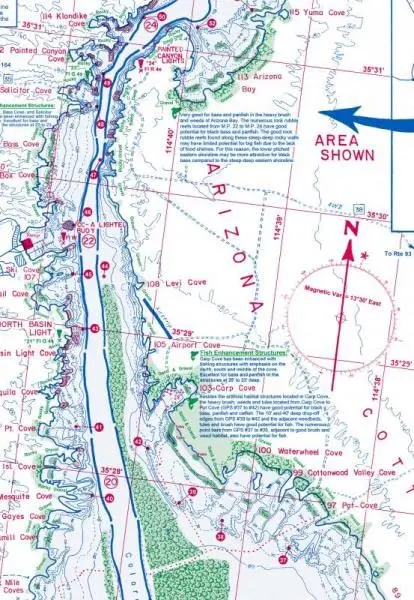
- Lake Mohave – Davis Dam to Hoover Dam
- Updated June 2020
- Additions and Improvements:
- Added Fish Habitat:
- Fair Rock Rubble
- Good Rock Rubble
- Submerged Weedbeds
- Updated the outline of the lake and depth contours where needed
- Updated GPS Coordinates
- Updated Fishing Strategy and Fishing Suggestions
- Added onshore brush and trees
- Added shoreline geological features such as “Steep Deep”, “Rocky Gravel”, “Slab Rock”, “Gravel”, etc.
- Updated facilities
- Added an additional color to the map – green
- Added Fish Habitat:
- Artificial Habitat Locations Updated in 2016
- Features:
- 10-foot underwater depth contours
- GPS locations and fish habitat areas identified.
- With longitude and latitude grids
- Fish locations
- Fishing strategy
- Submerged brush, roadbeds, houses & buildings, major river channels, and feeder creeks are identfied
- Boat ramps, roads, campgrounds, marinas, and facilities shown
- Waterproof, tear-resistant.
- Folds to 4″×9″; unfolds to 2’×3′.
- Made in the U.S.A.
- Two-sided, self-cover, plastic folded map.
Explore more from our collection.
![Apache Maid Mountain, Arizona 7.5' [Map] United States Geological Survey 1](https://carpartsvault.shop/wp-content/uploads/2026/05/410Z8JECelL._SL1000_dce0475b-5bbc-42d7-84d0-78eeff0231e4-2aslbs.tmp_.webp)
![Mexico Mapa De Carreteras [Paperback] Varios 1](https://carpartsvault.shop/wp-content/uploads/2026/05/51tf9UzB5fL._SL1000-92Yl7n.tmp_.webp)

Reviews
There are no reviews yet.