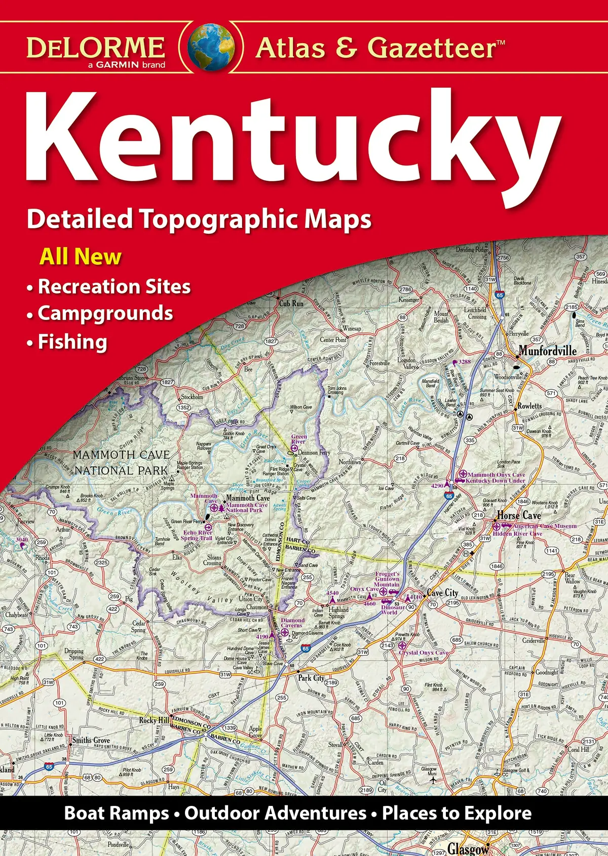
Description
Delorme Atlas & Gazetteer: Kentucky Rand McNally
- Full-color topographic maps provide information on everything from cities and towns to historic sites, scenic drives, recreation areas, trailheads, boat ramps and prime fishing spots
- Extensively indexed
- Handy latitude/longitude overlay grid for each map allows you to navigate with GPS
- Inset maps provided for major cities as well as all state lands
Explore more from our collection.
![Fontana And Hiwassee Lakes Map [Nantahala National Forest] (National Geographic Trails Illustrated Map, 784) [Map] National Geographic Maps - Trails Illustrated 1](https://carpartsvault.shop/wp-content/uploads/2026/05/7133jKa5FyL-sUiqw2.tmp_.webp)
![10,000 Garden Questions Answered By 20 Experts - Two Volume Set [Hardcover] Fish, Robert L. 1](https://carpartsvault.shop/wp-content/uploads/2026/05/71PrHMiBLbS-mPGQuc.tmp_.webp)
![Lake Powell And Its 96 Canyons Boating And Exploring Map [Map] Stan Jones And Steve Ward 1](https://carpartsvault.shop/wp-content/uploads/2026/05/81OXLNHhJYL_1090c6d2-c076-4aa6-8e50-e0ceb241a701-KgX9la.tmp_.webp)
Reviews
There are no reviews yet.