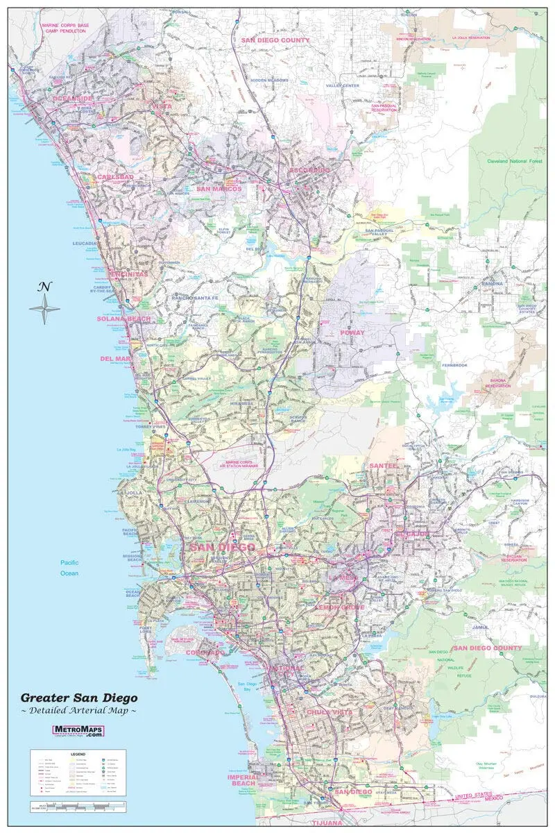
Description
Updated for 2019 – sharp and functional wall map of Greater San Diego.
This wall map offers the best of both worlds with a unique combination of detail and coverage. From Oceanside to the Mexico border and Ramona to La Jolla – the entire San Diego region is covered.
Every street is shown, with all major roads labeled. Freeways (with exit numbers), toll roads, airports, commuter rail lines, hospitals, colleges, parks, high schools, major points of interest, rivers, and major terrain features are all clearly indicated.
Ideal for the office, warehouse, classroom, or home. Laminated and ready to ship!
- Gloss laminated, one-sided, small 24″×36″, portrait-oriented wall map
Explore more from our collection.
![Dos Cabezas, Arizona 7.5' [Map] United Stated Geological Survey 1](https://carpartsvault.shop/wp-content/uploads/2026/05/421-gOAqhA.tmp_.webp)
![Ecuador, Quito, Guayaquil, Galapagos [Map] Pham Viet Hoa And Kevin Healey 1](https://carpartsvault.shop/wp-content/uploads/2026/05/41hS5ABEG-L._SL1000-lEpnia.tmp_.webp)
![Dino's Quiz Map Of The Solar System [Map] Dino Kalogjera And Sanja Kolaj 1](https://carpartsvault.shop/wp-content/uploads/2026/05/61n5FQ5hDBL._SL1000-TSWDOh.tmp_.webp)
Reviews
There are no reviews yet.