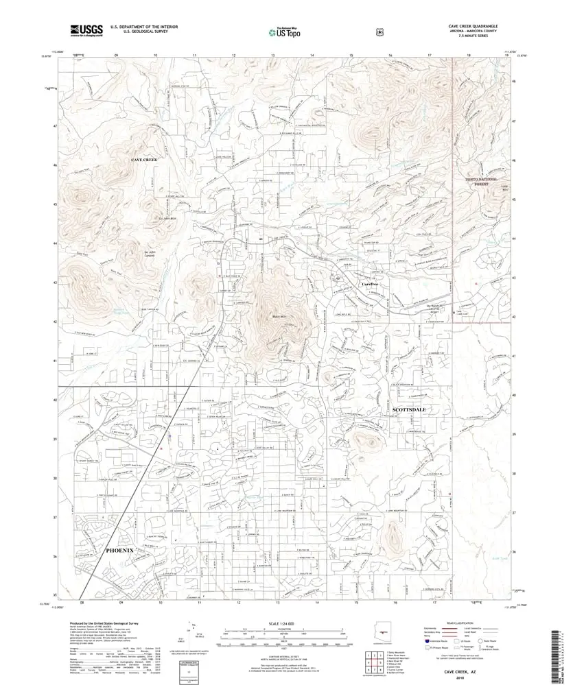
Description
Cave Creek, AZ, TNM 2018 UST USGS 7.5-minute topo quad map
- Product Details
- Product Number: 467214
- Scale: 1:24,000
- Content: Contours; US Topo
- Version Date: 01/01/2018
- Regions: AZ
- Countries: USA
- Latitude: 33° 52′ 30″ N to 33° 45′ 0″ N
- Longitude: 112° 0′ 0″ W to 111° 52′ 30″ W
- Media: Paper
- Format: Flat
- Historical Reproduction: No
- Additional Details
- Description: United States Geological Survey Cave Creek, Arizona The National Map US Topo 7.5×7.5 Grid 24000-Scale 2018
- Survey Date: 2015
- Print Date: 2018
- Height In Inches: 27.000
- Length In Inches: 22.000
- Boundary Type: Quadrangle
- UTM Grid: Grid
- Horizontal Datum: North American 1983
- Vertical Datum: National Geodetic 1988
- UTM: Zone 12S
- Two-Sided: No
- Plates: 1
- Pieces: 1
- Languages: English
Explore more from our collection.


Reviews
There are no reviews yet.