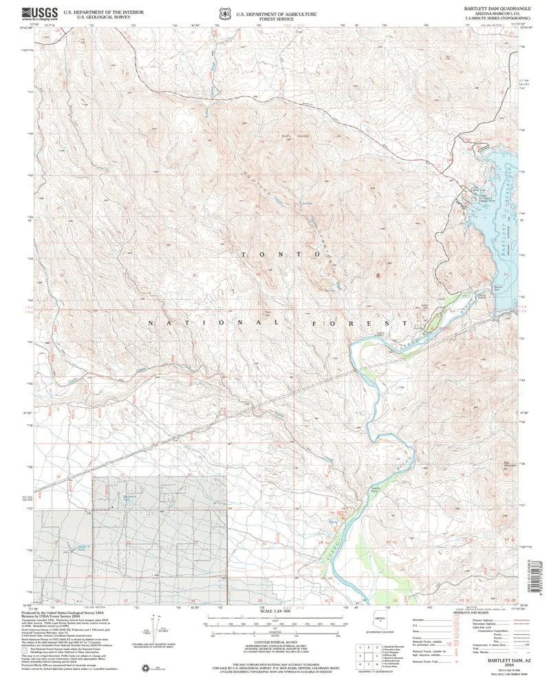
Description
Bartlett Dam, AZ 2004 USGS 7.5-minute topo quad map
- Product Details
- Product Number: 40546
- Scale: 1:24,000
- Content: Contours
- Alternate ID: TAZ0097
- ISBN: 978-1-4113-1436-8
- Version Date: 01/01/2004
- Regions: AZ
- Countries: USA
- Latitude: 33° 52′ 30″ N to 33° 45′ 00″ N
- Longitude: 111° 45′ 00″ W to 111° 37′ 30″ W
- Media: Paper
- Format: Flat
- Historical Reproduction: Yes
- Additional Details
- Description: United States Geological Survey Bartlett Dam, Arizona Historical Edition Reprint Map 7.5’×7.5′ Grid 24000-Scale 2004
- Survey Date: 1964
- Print Date: 1992
- Height In Inches: 27.000
- Length In Inches: 21.600
- Boundary Type: Quadrangle
- UTM Grid: Grid Lines
- Horizontal Datum: North American 1983; North American 1927
- Vertical Datum: National Geodetic 1929
- UTM: Zone 12
- Two-Sided: No
- Plates: 1
- Pieces: 1
- Languages: English
Explore more from our collection.

![Dino's Quiz Map Of The Solar System [Map] Dino Kalogjera And Sanja Kolaj 1](https://carpartsvault.shop/wp-content/uploads/2026/05/61n5FQ5hDBL._SL1000-TSWDOh.tmp_.webp)

Reviews
There are no reviews yet.