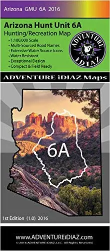
Description
Arizona Hunt Unit 6A Map – Exceptional Design and Readability – 1:100,000 Scale & Water Resistant – Multi-Sourced Road Names – Extensive Water Source Icons – Compact & Field Ready!
Hunt Unit 6A is Arizona’s most unique and versatile game management region offering diverse wildlife varieties and habitats found nowhere else in North America.
This unit will journey up to the high elevations of Arizona’s ponderosa forests, descending to the Pinon-Juniper belts, then to the high chaparral, down to the river basin touching the fringes of the Sonoran Desert; this region also offers a variety of riparian zones.
Unit 6A almost entirely lies within the Coconino National Forest, with small islands of private properties in various sections. This region is famed for offering one of the most diverse species of big game, such as trophy elk, mule deer, whitetail deer, rocky mountain bighorn sheep, antelope, mountain lion, black bear, turkey, and javelina.
There is excellent hunting for tree squirrel, cottontail rabbits, fox, coyote, bobcat, and more. Because there are vast numbers of lakes, tanks, ponds, rivers and streams, it produces good waterfowl hunting and fishing as well.
Access throughout Unit 6A is very good mainly by forest roads and trails. Please use caution when accessing them. Due to weather conditions and other restrictions, road closures can happen at any time without notice. To obtain further information about weather, camping and access, please contact the Coconino National Forest and other land agencies.
Adventure iDiaz Hunt Unit Maps are a tool supplement therefore will not be held liable or responsible for any mishaps.
AZ Hunting Unit 6A Map Information
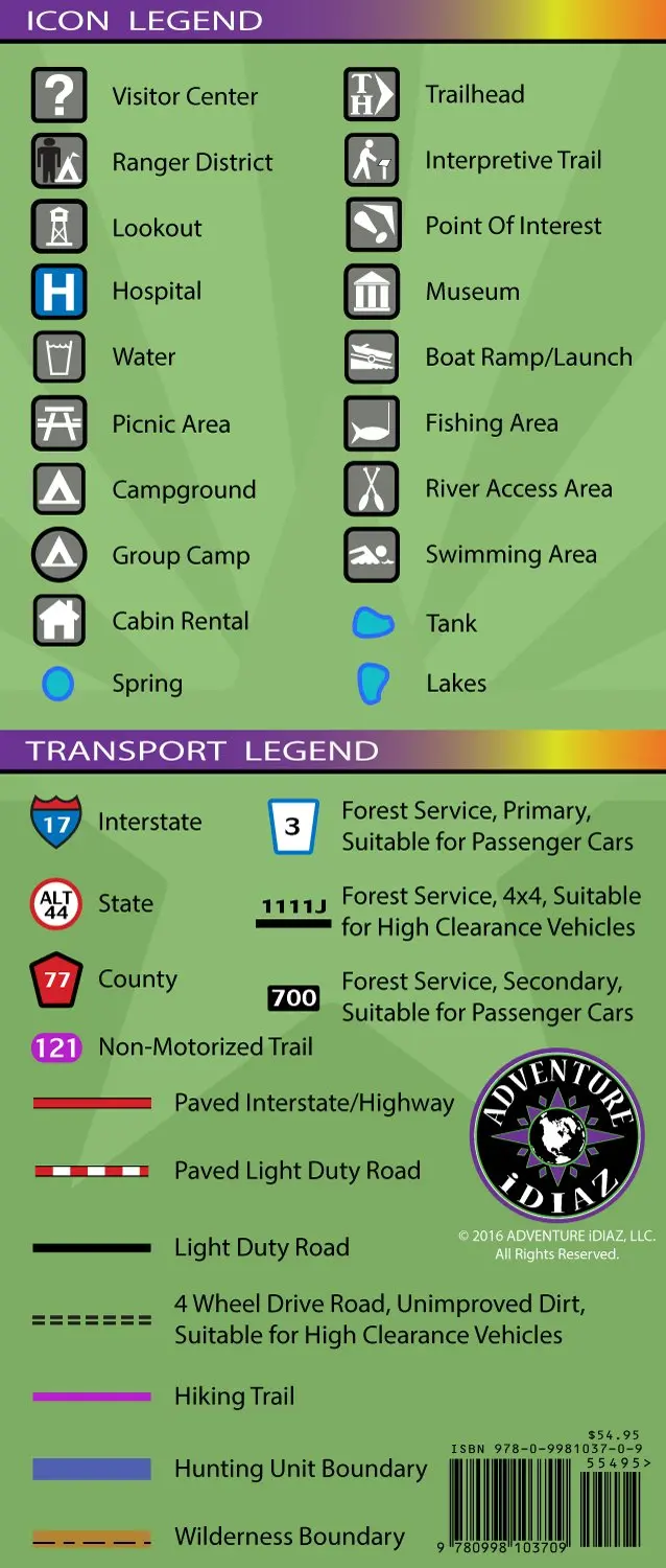
- 1:100,000 Scale – Detailed Topographic Map
- Multi-Sourced Road Names – Adventure Trails, 4 x 4 and Light Duty Roads
- Water Resistant – Tear Resistant, Durable Polypropylene
- Exceptional Design – Beautiful, High Quality Color & Detail
- Compact & Field Ready – Easy To Ready And Follow
- Extensive Water Source Icons – Clearly Marked Water Tanks & Spring Symbols
- 36″ × 41″ – Unfolded / 4.50″ × 10.25″ – Folded
- 620061-idiaz
Explore more from our collection.

![Apache Maid Mountain, Arizona 7.5' [Map] United States Geological Survey 1](https://carpartsvault.shop/wp-content/uploads/2026/05/410Z8JECelL._SL1000_dce0475b-5bbc-42d7-84d0-78eeff0231e4-2aslbs.tmp_.webp)
![Dome Rock Mts Sw, Arizona 7.5' [Map] United Stated Geological Survey 1](https://carpartsvault.shop/wp-content/uploads/2026/05/419-VJ68DR.tmp_.webp)
Reviews
There are no reviews yet.