Description
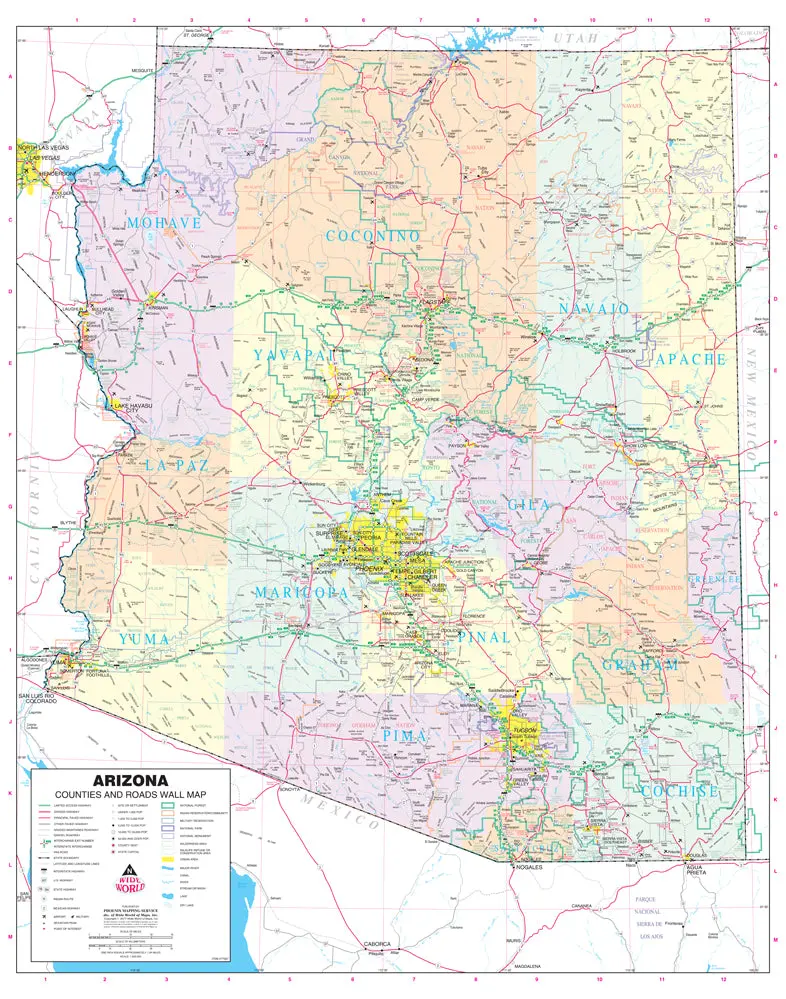
Phoenix Mapping Service Arizona Counties and Roads Small Wall Map, Gloss Ready-to-Hang is a State of Arizona color wall map detailing counties and roads in a small 23″×28″ size.
This detailed and up-to-date State of Arizona wall map defines counties with pastel coloring. Also included are cities and towns with relevant population information; all of the interstate, state, and tribal highways systems; rivers, streams, and lakes; mountain ranges; tribal lands, military reservations, wilderness areas, and wildlife refuges; and National Parks, Forests, and Monuments.
Gloss Lamination features premium optically clear film which provides a high shine for dramatic color presentation. The gloss laminated map is a convenient and useful at-a-glance reference ready for wet erase or alcohol erase markers, sticker dots or arrows, or graphic tape.
Ready-to-Hang maps have rails at the top and the bottom to keep the map flat against the wall with two loops on the top rail for easy hanging. A package of wall hooks and nails completes the set.
- Ready-to-hang, gloss laminated paper, one-sided wall map.
- Size = 24″×30″
Explore more from our collection.

![Mexico Mapa De Carreteras [Paperback] Varios 1](https://carpartsvault.shop/wp-content/uploads/2026/05/51tf9UzB5fL._SL1000-92Yl7n.tmp_.webp)

Reviews
There are no reviews yet.