Description
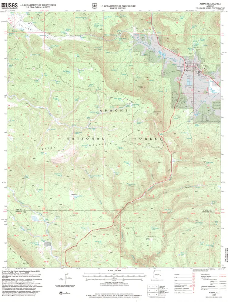
Alpine, AZ 1997 USGS 7.5-minute quadrangle map
- Product Details
- Product Number: 42513
- Scale: 1:24,000
- Content: Contours
- Alternate ID: TAZ2111
- ISBN: 978-0-607-95789-1
- Version Date: 01/01/1997
- Regions: AZ
- Countries: USA
- Latitude: 33° 52′ 30″ N to 33° 45′ 00″ N
- Longitude: 109° 15′ 00″ W to 109° 07′ 30″ W
- Media: Paper
- Format: Flat
- Historical Reproduction: Yes
- Additional Details
- Description: United States Geological Survey Alpine, Arizona Historical Map Reprint 7.5’×7.5′ Grid 24000-Scale 1997
- Survey Date: 1997
- Print Date: 2000
- Height In Inches: 26.700
- Length In Inches: 21.600
- Boundary Type: Quadrangle
- UTM Grid: Grid Ticks
- Horizontal Datum: North American 1983; North American 1927
- Vertical Datum: National Geodetic 1929
- UTM: Zone 12
- Two-Sided: No
- Plates: 1
- Pieces: 1
- Languages: English
Explore more from our collection.


![Douglas Ne 7.5', Arizona [Map] United Stated Geological Survey 1](https://carpartsvault.shop/wp-content/uploads/2026/05/410Z8JECelL._SL1000_960643bf-125f-462b-8727-48bf6bdc1077-1K0TR9.tmp_.webp)
Reviews
There are no reviews yet.