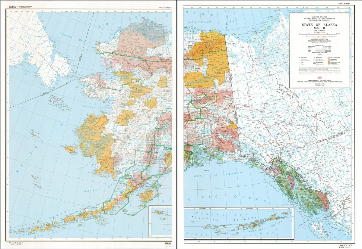
Description
This colorful, two-piece map shows cities and towns, highways and roads, rivers, streams and lakes, and political boundaries of Alaska. Further shown are parks and recreational areas, National Wildlife Refuges, and Indian Reservations. Contour lines are also shown on this map.
One piece comprises everything west of 150° West while other other everything east of 150° West.
Two-piece paper, one-sided wall map.
Projection = Modified Transverse Mercator
Scale = 1:1,584,000
Horizontal Datum = North American 1927
Vertical Datum = National Geodetic 1929
Contour Interval = 1000′
Size:
* West = 39″ x 54.5″
* East = 25″ x 53″
Explore more from our collection.

![Dike Tank 7.5' Arizona 1980 [Map] United Stated Geological Survey 1](https://carpartsvault.shop/wp-content/uploads/2026/05/410Z8JECelL._SL1000_ff8cf6a6-59ba-4b88-b5f2-991ca26dc2b6-5zS0Jb.tmp_.webp)
![Dome Rock Mts Sw, Arizona 7.5' [Map] United Stated Geological Survey 1](https://carpartsvault.shop/wp-content/uploads/2026/05/419-VJ68DR.tmp_.webp)
Reviews
There are no reviews yet.