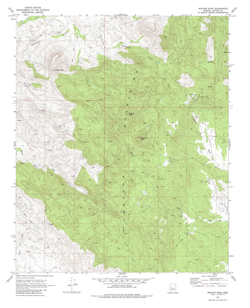
Description
Weaver Pk, AZ 1969 USGS 7.5-minute topo quad map
- Product Details
- Product Number: 42010
- Scale: 1:24,000
- Content: Contours
- Alternate ID: TAZ1570
- ISBN: 978-0-607-07362-1
- Version Date: 01/01/1969
- Regions: AZ
- Countries: USA
- Latitude: 34° 22′ 30″ N to 34° 15′ 0″ N
- Longitude: 112° 52′ 30″ W to 112° 45′ 0″ W
- Media: Paper
- Format: Flat
- Historical Reproduction: Yes
- Additional Details
- Description: United States Geological Survey Weaver Peak, Arizona Historical Map Reprint 7.5×7.5 Grid 24000-Scale 1969
- Survey Date: 1969
- Print Date: 1972
- Height In Inches: 26.700
- Length In Inches: 22.000
- Boundary Type: Quadrangle
- UTM Grid: Ticks
- Horizontal Datum: North American 1927
- Vertical Datum: National Geodetic 1929
- UTM: Zone 12
- Two-Sided: No
- Plates: 1
- Pieces: 1
- Languages: English
Explore more from our collection.
![Mexico Mapa De Carreteras [Paperback] Varios 1](https://carpartsvault.shop/wp-content/uploads/2026/05/51tf9UzB5fL._SL1000-92Yl7n.tmp_.webp)
![Dike Tank 7.5' Arizona 1980 [Map] United Stated Geological Survey 1](https://carpartsvault.shop/wp-content/uploads/2026/05/410Z8JECelL._SL1000_ff8cf6a6-59ba-4b88-b5f2-991ca26dc2b6-5zS0Jb.tmp_.webp)
![Baja Peninsula Infared From Space Satellite Map Gloss Laminated [Map] Spaceshots Inc. 1](https://carpartsvault.shop/wp-content/uploads/2026/05/41DKYrRbd2L._SL1000_804c6dca-6d63-4e78-ba5f-aedfab787fff-h4Bc68.tmp_.webp)
Reviews
There are no reviews yet.