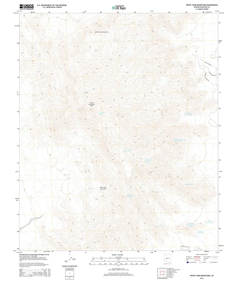
Description
White Tank Mtns, AZ, TNM 2014 UST USGS 7.5-minute top quad map
- Product Details
- Scale: 1:24,000
- Content: Contours; US Topo
- Draft Version: 0.6.16
- Version Date: 01/01/2014
- Regions: AZ
- Countries: USA
- Latitude: 33° 37′ 30″ N to 33° 30′ 00″ N
- Longitude: 112° 37′ 30″ W to 112° 30′ 00″ W
- Media: Paper
- Format: Flat
- Historical Reproduction: Yes
- Additional Details
- Description: United States Geological Survey White Tank Mountains, Arizona, The National Map (Formerly White Tank Mountains Southeast) Historical Reprint 7.5’×7.5′ Grid 1:24,000-Scale US Topo 2014
- Survey Date: 2014
- Print Date: 2014
- Height In Inches: 29.000
- Length In Inches: 24.000
- Boundary Type: Quadrangle
- UTM Grid: Grid Lines
- Horizontal Datum: North American 1983
- Vertical Datum: National Geodetic 1988
- UTM: Zone 12S
- Two-Sided: No
- Plates: 1
- Pieces: 1
- Languages: English
Explore more from our collection.

![Dome Rock Mts Sw, Arizona 7.5' [Map] United Stated Geological Survey 1](https://carpartsvault.shop/wp-content/uploads/2026/05/419-VJ68DR.tmp_.webp)

Reviews
There are no reviews yet.