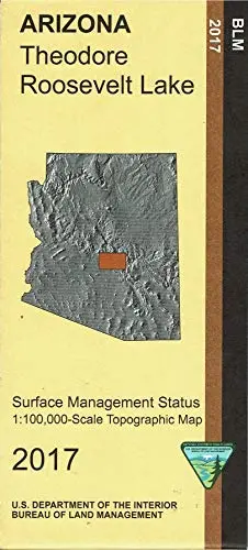
Description
Differentiates between public and private land, and also among the various agencies who manage the public lands. The map shows Tonto National Forest, McDowell Mountain County Regional Park, and four wilderness areas. Explore the Four Peaks Wilderness and the Superstition Mountains Wilderness. Scenic driving on Highway 88 from Apache Junction to Roosevelt Lake. Camping, backpacking, hiking, and regulated OHV use in the national forest. Enjoy boating, fishing, swimming, camping, and picnicking at some of the four reservoir lakes along Highway 88. Map is useful for AZ Hunting Units 21, 22, 23, and 24B. Scale 1:100,000. 2017.
- One-sided, self-cover, paper/non-laminated folded map
Explore more from our collection.
![Douglas Ne 7.5', Arizona [Map] United Stated Geological Survey 1](https://carpartsvault.shop/wp-content/uploads/2026/05/410Z8JECelL._SL1000_960643bf-125f-462b-8727-48bf6bdc1077-1K0TR9.tmp_.webp)


Reviews
There are no reviews yet.