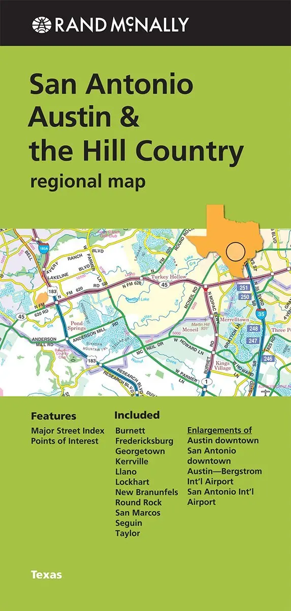
Description
Rand McNally‘s folded map for San Antonio, Austin, & the Hill Country is a must-have for anyone traveling in and around this part of Texas, offering unbeatable accuracy and reliability at a great price. Our trusted cartography shows all Interstate, U.S., state, and county highways, along with clearly indicated parks, points of interest, airports, county boundaries, and streets. The easy-to-use legend and detailed index make for quick and easy location of destinations. You’ll see why Rand McNally folded maps have been the trusted standard for years.
- Regularly updated
- Full-color maps
- Clearly labeled Interstate, U.S., state, and county highways
- Indications of parks, points of interest, airports, county boundaries, and downtown & vicinity maps
- Major attractions & Golf Courses
- Enlargements of Austin downtown, San Antonio downtown, Austin-Bergstrom Intl Airport, and San Antonio Intl Airport.
- Easy-to-use legend
- Detailed index & Major Street Index
- Convenient folded size
- © 15 April 2014
- Communities Included: Burnett, Fredericksburg, Georgetown, Kerrville, Llano, Lockhart, New Branunfels, Round Rock, San Marcos, Seguin, and Taylor
Explore more from our collection.


![Dos Cabezas, Arizona 7.5' [Map] United Stated Geological Survey 1](https://carpartsvault.shop/wp-content/uploads/2026/05/421-gOAqhA.tmp_.webp)
Reviews
There are no reviews yet.