Description
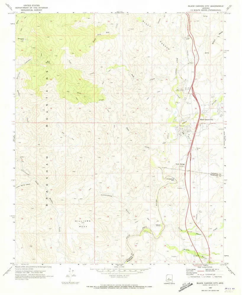
USGS 7.5-minute topo quad map
- Long Name: Black Canyon City, Arizona Historical Map Reprint 7.5’×7.5′ Grid 24000-Scale 1969
- Scale: 1:24,000
- Content: Contours
- Alternate ID: TAZ0142
- ISBN: 978-0-607-06309-7
- Version Date: 1969
- Regions: AZ
- Nations: USA
- Latitude: 34° 0′ 0″ N to 34° 7′ 30″ N
- Longitude: 112° 15′ 0″ W to 112° 7′ 30″ W
- Media: Paper
- Format: Flat
- Description: United States Geological Survey 7.5-minute topographic quadrangle map for Black Cyn City, AZ
- Survey Date: 1969
- Print Date: 1973
- Height In Inches: 26.900
- Width In Inches: 22.000
- Boundary Type: Quadrangle
- UTM Grid: Yes
- Horizontal Datum: North American 1927 (NAD27)
- Vertical Datum: Mean Sea Level
- UTM: Zone 12
- Two-Sided: No
- Plates: 1
- Pieces: 1
- Languages: English
Explore more from our collection.
![Mexico Mapa De Carreteras [Paperback] Varios 1](https://carpartsvault.shop/wp-content/uploads/2026/05/51tf9UzB5fL._SL1000-92Yl7n.tmp_.webp)


Reviews
There are no reviews yet.